The work site, the main sites of the object «Construction of a gas measuring station and a shift settlement on the Gazli-Shymkent gas pipeline 314 km» is actually located on the 312 km of the Gazli-Shymkent gas pipeline, 2 km from the border with the Republic of Uzbekistan and is located 255 km in the south-south-west direction from the regional center of Turkestan, 265 km southwest of Shymkent, 105 km west of the Shardara district center.
From the sites of the Geoinformation System and the shift settlement, in the direction to the east, along the main gas pipeline «Gazli-Shymkent», the existing 10 kV overhead line passes, which is subject to reconstruction, its soldering is located at the Komsomol substation, in the village of Uzynata, so it can be assumed that the worksite has a length of about 120 km, from the border with the Republic of Uzbekistan to the village of Uzynata, which is located in the floodplain of the Syr-Darya River, on its left bank. The terrain is represented by ridge-cellular sands, sometimes up to 30 meters high.
The projected site is located in the Shardarinsky district, Turkestan region, the Republic of Kazakhstan.
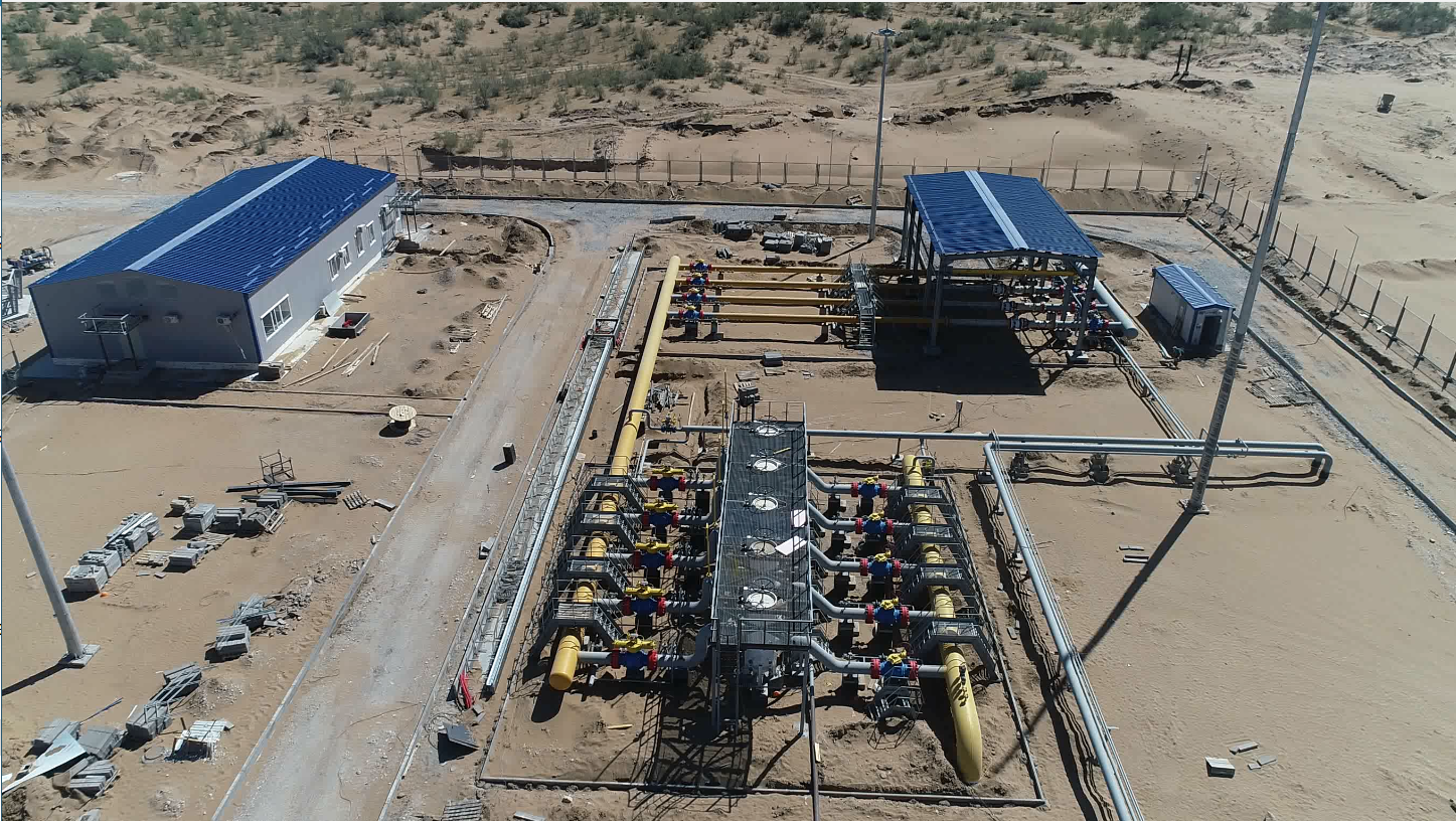
The main objective of the project was the construction of a gas measuring station with service complexes, which includes the following sites:
- gas measuring station and water intake site
- shift settlement
- evaporator pond
- crane units.
The construction of a gas measuring station site and a water intake site for providing drinking water to working personnel is being considered. For landing on the territory, an architectural solution is proposed for the operator’s building and an engineering solution consisting of a sewage pumping station, a satellite antenna, a diesel power plant, a gas piston power plant, a diesel fuel tank, a fire extinguishing pumping station, a fire fighting tank, and a water supply pumping station (Block box), a ground pavilion above the well (Block box) on the territory of the water intake site.
The projected site is located in the Shardarinsky district, Turkestan region, the Republic of Kazakhstan. The construction site is uneven, the terrain is ridge-cellular sands, densely overgrown with saxaul, with relief marks from +265.80 to +270.50, has a rectangular shape, and occupies the territory of 0.9960 ha (the territory of the gas measuring station) and 0.4980 ha (water intake site) according to the state act, as well as the project decided to improve and cut off the elevation of the relief of the adjacent territory with an area of 0.6809 Ha with the placement of the projected access road to the sites and parking for 6 cars/places.
Landscaping of the territory is provided:
— installation of benches;
